banniere TrackandRoad
| Connect

Aidez le site : faites un don Paypal

La piste du col de la Finestre

Take part

Don't forget to publish your favourite biking roads.

Use Motorbike-roadbooks

You can create custom roadbooks based on these roads by using software Motorbike-Roadbooks. For a first use, you can have a look at the tutorial.
Map

Zoom back to initial map

Pictures

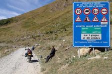
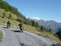
par moi-même en 1987par heinrich-gs
par Howard G. Millichap

Marks

The roadbook

57.7 km (about 1 h 34 min)

Stage Instructions Distance Zoom crossing
Sestriere 0 km
1 Head northeast on SR23 toward Piazzale Kandahar
Go through 1 roundabout
PK : 0 km
(-> 0.6 km)
2 Slight left at Via Colle Basset/SP173 PK : 0.6 km
(-> 0.4 km)
3 Slight left at SP173 PK : 1 km
(-> 1.9 km)
4 Turn right to stay on SP173 PK : 3 km
(-> 0 km)
5 Turn right to stay on SP173 PK : 3 km
(-> 14 km)
6 Turn right to stay on SP173
Destination will be on the left
PK : 17.1 km
(-> 5.6 km)
7 Head east on SP173 PK : 22.8 km
(-> 1.4 km)
8 Turn left to stay on SP173 PK : 24.2 km
(-> 0.1 km)
9 Slight left to stay on SP173 PK : 24.4 km
(-> 11.1 km)
10 Sharp left at SP172 PK : 35.5 km
(-> 18.3 km)
11 Continue on Via Colle delle Finestre PK : 53.8 km
(-> 0.8 km)
12 Slight left to stay on Via Colle delle Finestre PK : 54.7 km
(-> 0.3 km)
13 Turn right at Via Colle delle Finestre/SP172
Continue to follow SP172
PK : 55.1 km
(-> 1.2 km)
14 Turn left at Via Meana/SSP24 PK : 56.4 km
(-> 0.5 km)
15 Turn right at Via degli Alpini/SP241 PK : 56.9 km
(-> 0.2 km)
16 Turn left at Corso Stati Uniti/SS25
Continue to follow SS25
Destination will be on the left
PK : 57.1 km
(-> 0.6 km)
Susa 57.7 km

Nearby roads

  • See roads closer than : kms

Research radius : 100 km

Road Length Distance / Active road Mark
Col du Petit Saint Bernard 60.4 km 57 km 4.1/5
Breuil Cervinia 30.4 km 82 km 4/5
Les balcons de Belledonne 81.7 km 85 km 3.9/5
Bonette pass (2815 m) 47.2 km 60 km 3.8/5
Vars pass (2109 m) 40.5 km 38 km 3.8/5
Gorges du Guier mort 9.3 km 94 km 3.8/5
Gorges de Daluis 19.3 km 96 km 3.8/5
Col de la Cayolle (2326 m) 59.2 km 67 km 3.8/5
Le Col de Frene 10.1 km 84 km 3.8/5
Col d'Izoard (2361m) 29.6 km 20 km 3.8/5
Vignoble d'Asti 63.1 km 94 km 3.8/5
Cormet de Roselend pass (1968 m) 39.3 km 58 km 3.7/5
Route des Saisies 32.2 km 79 km 3.7/5
Pas du Frou 10.4 km 95 km 3.7/5
Iseran pass 47.2 km 20 km 3.6/5
Col du Mont Cenis 40.6 km 0 km 3.6/5
Traversé de la Chartreuse 62.5 km 94 km 3.5/5
La chartreuse en automne 11.6 km 93 km 3.5/5
Télégraphe and Galibier pass 42.9 km 38 km 3.4/5
Le long du lac de Serre-Ponçon 24.6 km 61 km 3.3/5
Entre Drome et Serre Ponçon 28.2 km 84 km 3.3/5
Sud du Mercantour (1) 23.8 km 99 km 3.3/5
Aravis pass (1487 m) 18 km 86 km 3.2/5
Montets pass(1461 m) 13.8 km 90 km 3.2/5
Tarentaise valley 24.4 km 55 km 3.2/5
Durance and south of Serre Ponçon 35.4 km 68 km 3/5

Nearby Accomodations

  • See accomodations closer than : km

Research radius : 100 km

Name Type Distance / Active road Mark Zoom
Location saisonnière Serre CHe 1200 Others 19 km 4.2/5
Les méans Bed and breakfast 67 km 3.2/5

Your opinion

There is no opinion about this road yet.