Cormet de Roselend pass (1968 m)
- Published by Thomas on wednesday, october 29th 2008
- Length : 39.3 km
- Estimated time : 35 min
- Country : France
- GPS files: (Help)

- General mark : 3.7/5

Take part
Use Motorbike-roadbooks
You can create custom roadbooks based on these roads by using software Motorbike-Roadbooks. For a first use, you can have a look at the tutorial.
Map
Zoom back to initial map
Description
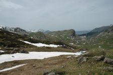
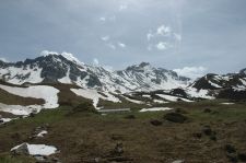
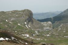
Cormet de Roselend...one of my favourite Alpine pass. It's not the highest neither the most famous, but here are two reasons why you should go there :
- There is few traffic
- The view on Roselend lake is definitely wonderful
- Road surfacing is very good, excepted when arriving on Bourg Saint Maurice
Welle these two reasons are in fact three! Go there !
Pictures
Marks
- Surfacing : 3/5

- Curves : 3.5/5

- Landscapes : 4.5/5

- Speed controls : 3.5/5
 (high mark = few controls)
- Traffic : 3.5/5
 (high mark = few traffic)
The roadbook
39.3 km (about 33 min)
| Stage |
Instructions |
Distance |
Zoom crossing |
 |
Beaufort |
0 km |
 |
| 1 |
Head southeast on D925/Grande Rue toward Montée d'Outray Continue to follow D925 This road may be seasonally closed |
PK : 0 km
(-> 12.1 km) |
 |
| 2 |
Turn left to stay on D925 This road may be seasonally closed Destination will be on the right |
PK : 12.1 km
(-> 5 km) |
 |
| 3 |
Head east on D925 toward Chalets du Plan de la Lai/D925 This road may be seasonally closed |
PK : 17.2 km
(-> 2.9 km) |
 |
| 4 |
Continue onto D902 This road may be seasonally closed |
PK : 20.2 km
(-> 10.8 km) |
 |
| 5 |
Turn left to stay on D902 This road may be seasonally closed |
PK : 31 km
(-> 8.2 km) |
 |
 |
Bourg Saint Maurice |
39.3 km |
 |
Nearby roads
Research radius : 100 km
| Road |
Length |
Distance / Active road |
Mark |
Nearby Accomodations
Research radius : 100 km
| Name |
Type |
Distance / Active road |
Mark |
Zoom |
Your opinion
There is no opinion about this road yet.


 |
|


