banniere TrackandRoad
| Connect

Aidez le site : faites un don Paypal

Road 17 (Norwegian coast)

Take part

Don't forget to publish your favourite biking roads.

Use Motorbike-roadbooks

You can create custom roadbooks based on these roads by using software Motorbike-Roadbooks. For a first use, you can have a look at the tutorial.

Map

Zoom back to initial map

Description

This road is an invitation to travel. You go from one island to another using ferrie boat. IN fact, vehicles go by group, according to ferries disembarcations. If I remember well, there are 7. Be careful about cost.

It's really amazing, and you will need at least 2 days to do it.

(sorry to make it so long, but i cannot cut it !)
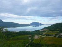
Pictures


Marks

The roadbook

708.8 km (about 12 h 40 min)

Stage Instructions Distance Zoom crossing
Bodo 0 km
1 Head north toward Route 80/Sjøgata PK : 0 km
(-> 0 km)
2 Turn right at Route 80/Sjøgata
Continue to follow Route 80
Go through 3 roundabouts
PK : 0 km
(-> 18.2 km)
3 Turn right at Route 17 PK : 18.2 km
(-> 101.4 km)
4 Turn right at Havneveien
Destination will be on the right
PK : 119.7 km
(-> 0.1 km)
5 Head northwest on Havneveien toward Havneveien PK : 119.8 km
(-> 0.1 km)
6 Turn right at Route 17/Kystveien
Continue to follow Route 17
PK : 120 km
(-> 51 km)
7 Turn left to stay on Route 17 PK : 171 km
(-> 2.7 km)
8 Turn left to stay on Route 17 PK : 173.7 km
(-> 0.1 km)
9 Take the Route 17/Forøya - Ågskardet ferry PK : 173.9 km
(-> 2.7 km)
10 Continue straight onto Route 17 PK : 176.6 km
(-> 0.2 km)
11 Turn left to stay on Route 17 PK : 176.9 km
(-> 27.4 km)
12 Take the Route 17/Jektvik - Kilboghamn ferry PK : 204.4 km
(-> 18.7 km)
13 Continue straight onto Route 17 PK : 223.2 km
(-> 4.9 km)
14 Turn left to stay on Route 17 PK : 228.1 km
(-> 54.7 km)
15 Turn right to stay on Route 17 PK : 282.9 km
(-> 30.7 km)
16 Take the Route 17/Nesna - Levang ferry to Leirfjord PK : 313.6 km
(-> 8.4 km)
17 Continue straight onto Route 17 PK : 322 km
(-> 1 km)
18 Turn right to stay on Route 17 PK : 323.1 km
(-> 31.2 km)
19 At the roundabout, take the 2nd exit and stay on Route 17 PK : 354.4 km
(-> 37.2 km)
20 Turn right to stay on Route 17 PK : 391.7 km
(-> 0 km)
21 Turn left to stay on Route 17 PK : 391.7 km
(-> 0 km)
22 Head southeast on Route 17 toward Route 17/Svinesveien PK : 391.7 km
(-> 0.2 km)
23 Take the Route 839/Igerøy - Tjøtta ferry to Vega PK : 391.9 km
(-> 21.7 km)
24 Take the Route 839/Horn - Ylvingen - Igerøy ferry PK : 413.6 km
(-> 4.5 km)
25 Take the Horn - Ylvingen - Igerøy ferry to Brønnøy PK : 418.2 km
(-> 9.3 km)
26 Continue straight onto Route 17 PK : 427.5 km
(-> 10.9 km)
27 Turn left at Route 17/Route 76
Continue to follow Route 17
PK : 438.5 km
(-> 46.3 km)
28 Slight left PK : 484.8 km
(-> 0 km)
29 Slight right PK : 484.9 km
(-> 0.2 km)
30 Turn left
Destination will be on the right
PK : 485.1 km
(-> 0.1 km)
31 Head south PK : 485.3 km
(-> 0.1 km)
32 Turn left toward Route 17 PK : 485.4 km
(-> 0.2 km)
33 Turn left at Route 17 PK : 485.7 km
(-> 0 km)
34 Take the Route 17/Holm - Vennesund ferry to Bindal PK : 485.8 km
(-> 5.4 km)
35 Continue straight onto Route 17 PK : 491.2 km
(-> 41 km)
36 Turn left to stay on Route 17
Go through 1 roundabout
PK : 532.3 km
(-> 102.3 km)
37 Turn left at Route 769/Namdalsvegen PK : 634.6 km
(-> 0 km)
38 Continue on Route 17
Destination will be on the right
PK : 634.6 km
(-> 0.6 km)
39 Head south on Route 17 toward Holmenvegen PK : 635.2 km
(-> 66.4 km)
40 Turn left to stay on Route 17 PK : 701.6 km
(-> 0 km)
41 Sharp right at E6 PK : 701.7 km
(-> 2.8 km)
42 Take the exit PK : 704.6 km
(-> 0.2 km)
43 Slight left toward Våttavegen PK : 704.8 km
(-> 2.1 km)
44 Turn left toward Våttavegen PK : 706.9 km
(-> 0.4 km)
45 Continue straight onto Våttavegen PK : 707.3 km
(-> 1 km)
46 Turn left at Kvennavikgata PK : 708.3 km
(-> 0 km)
47 Turn left at Kalv Arnesons gate PK : 708.4 km
(-> 0 km)
48 Turn right at Flathaugvegen PK : 708.4 km
(-> 0.1 km)
49 Slight left at Martensvegen PK : 708.6 km
(-> 0.2 km)
steinkjer 708.8 km

Nearby roads

  • See roads closer than : kms

Research radius : 100 km

Road Length Distance / Active road Mark
Lofoten Islands 264.9 km 89 km 4/5

Nearby Accomodations

  • See accomodations closer than : km

There is no accomodation closer than 100 kms. Increase research radius (max 250 km).

Your opinion

There is no opinion about this road yet.