banniere TrackandRoad
| Connect

Aidez le site : faites un don Paypal

Régul BMW

Take part

Don't forget to publish your favourite biking roads.

Use Motorbike-roadbooks

You can create custom roadbooks based on these roads by using software Motorbike-Roadbooks. For a first use, you can have a look at the tutorial.
Map

Zoom back to initial map

Pictures

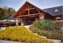
Arrivée Hameau du fromage

Marks

The roadbook

43.4 km (about 1 h 04 min)

Stage Instructions Distance Zoom crossing
Besançon 0 km
1 Head northwest on Rue François Villon PK : 0 km
(-> 0.1 km)
2 Turn right toward D673 PK : 0.1 km
(-> 0 km)
3 At the roundabout, take the 3rd exit onto the D673 ramp to A36/Dole/Dijon/Chaumont/Gray PK : 0.2 km
(-> 0 km)
4 Merge onto D673 PK : 0.3 km
(-> 0.3 km)
5 Take the D105 exit toward Montferrand-le-Château/Boussiéres/La Belle Étoile PK : 0.7 km
(-> 0.1 km)
6 At the roundabout, take the 2nd exit onto D105 PK : 0.9 km
(-> 0.2 km)
7 At the roundabout, take the 1st exit and stay on D105
Go through 1 roundabout
PK : 1.2 km
(-> 5.6 km)
8 Turn right onto Rue de Surotte
Destination will be on the left
PK : 6.8 km
(-> 0 km)
9 Head northeast on Rue de Surotte toward Route de Besançon/D105 PK : 6.8 km
(-> 0 km)
10 Turn right onto Route de Besançon/D105
Continue to follow D105
PK : 6.8 km
(-> 2.2 km)
11 Turn left onto Rue de l'Église
Destination will be on the left
PK : 9.1 km
(-> 0 km)
12 Head southwest on Rue de l'Église toward Rue du Centre/D104 PK : 9.2 km
(-> 0 km)
13 Turn left onto Rue du Centre/D104 PK : 9.2 km
(-> 0 km)
14 Continue onto Route de Quingey/D105
Continue to follow D105
PK : 9.3 km
(-> 1.7 km)
15 Turn left onto D107 PK : 11 km
(-> 3.1 km)
16 Turn right onto Imp. des Granges
Destination will be on the right
PK : 14.2 km
(-> 0 km)
17 Head northeast on Imp. des Granges toward Rue Jouffroy d'Abbans/D107 PK : 14.2 km
(-> 0 km)
18 Take the 1st right onto Rue Jouffroy d'Abbans/D107
Continue to follow D107
PK : 14.2 km
(-> 0.9 km)
19 Turn left onto Route de Quingey/D13
Continue to follow D13
PK : 15.2 km
(-> 2.3 km)
20 Turn right onto Rue Charles Prillard/D17
Continue to follow D17
PK : 17.5 km
(-> 0.5 km)
21 Turn right onto Pl. d'Armes/D17
Destination will be on the right
PK : 18.1 km
(-> 0 km)
22 Head east on Pl. d'Armes/D17 toward D13 PK : 18.1 km
(-> 0 km)
23 Turn right onto Pl. d'Armes/D13
Continue to follow D13
PK : 18.2 km
(-> 0.2 km)
24 Turn left onto Route d'Ornans/D101
Continue to follow D101
PK : 18.4 km
(-> 1.7 km)
25 Turn left onto D286 PK : 20.2 km
(-> 0.6 km)
26 Continue onto Grande Rue/D110A
Destination will be on the left
PK : 20.8 km
(-> 0.1 km)
27 Head northeast on Grande Rue/D110A toward Chemin du Dauphiné
Continue to follow D110A
PK : 21 km
(-> 4.9 km)
28 Turn left onto Route du Village/D110
Continue to follow D110
PK : 25.9 km
(-> 1.6 km)
29 Head north on D110 PK : 27.6 km
(-> 0.3 km)
30 Take the 1st right to stay on D110 PK : 28 km
(-> 0.2 km)
31 Take the 2nd right onto Route d'Epeugney/D440 PK : 28.2 km
(-> 1.2 km)
32 Turn left to stay on Route d'Epeugney/D440
Continue to follow D440
PK : 29.4 km
(-> 6.2 km)
33 Turn left onto D101 PK : 35.6 km
(-> 0.6 km)
34 Turn right onto Rue du Vide Gousset/D9
Continue to follow D9
PK : 36.2 km
(-> 7 km)
35 Turn right onto Les Épaisses PK : 43.3 km
(-> 0 km)
36 Turn left to stay on Les Épaisses PK : 43.4 km
(-> 0 km)
Cleron 43.4 km

Nearby roads

  • See roads closer than : kms

Research radius : 100 km

Road Length Distance / Active road Mark
Vers le Lac Genin 11.1 km 99 km 3.7/5
Tour de haute saone2 78.8 km 54 km 3.7/5
D97 - Plancher Bas -> Melisey 13.2 km 78 km 3.7/5
D23 - Remiremont -> Val d'Ajol 15.1 km 88 km 3.7/5
Ballon d'alsace pass from Sewen 10.4 km 93 km 3.6/5
Pont de Pany Pont d'Ouche par Urcy 48.1 km 86 km 3.6/5
Chatillonnais - Vallée de la tille 71.1 km 71 km 3.6/5
D20 - Val d'Ajol -> Plombières 8.3 km 88 km 3.6/5
Pontarlier Morteau (D437) 94.5 km 28 km 3.5/5
Tour de haute saone1 63.5 km 52 km 3.5/5
D486 - Col des croix 15.5 km 81 km 3.5/5
Rocher de Granges 22.3 km 98 km 3.5/5
St Laurent - Lac de Vouglans 38.4 km 56 km 3.4/5
D136 : Raddon - Route des forts 16.8 km 79 km 3.3/5
Entre Doubs et Jura Part 1 110.1 km 30 km 3.2/5
De la départementale pour rejoindre le Ballon ;-) 38.7 km 73 km 3.2/5
Doubs sud 60.4 km 20 km 3.1/5
From Oyonnax to St Claude 33.6 km 78 km 3.1/5
Le Crêt Pela 15.7 km 68 km 3.1/5
Towards Jura lakes 49.3 km 29 km 3.1/5
Cascades du Hérisson 22.8 km 56 km 3.1/5
Vallée de l'Ouche - Vitteaux 52.7 km 94 km 3.1/5
Ballon d'Alsace (1247 m) 40.4 km 88 km 3/5
Vouglans lake (west coast) 38.5 km 70 km 3/5
French Sibéria 53.3 km 31 km 2.9/5
Vallée de Joux 29.6 km 42 km 2.9/5
Les Pontins - Mt Crosin 20.8 km 69 km 2.9/5
Through Doubs region 47.6 km 29 km 2.8/5
Heights of Saint Claude (Jura) 26.8 km 77 km 2.8/5
Descente vers Thonon depuis la Suisse 14.7 km 86 km 2.8/5
De Nantua à Oyonnax 31.6 km 96 km 2.8/5
De St Claude à Morez, version express 27.4 km 62 km 2.6/5
Pays de Gex and faucille pass 47.7 km 56 km 2.5/5
St-Cergue 20 km 72 km 2.5/5
Gorges de l'ain 79.6 km 93 km 2.4/5

Nearby Accomodations

  • See accomodations closer than : km

Research radius : 100 km

Name Type Distance / Active road Mark Zoom
gite de la petite cote Bed and breakfast 83 km 4.6/5
Domaine A l'orée des buis Bed and breakfast 97 km 4.5/5
Chambres d'hotes MILLIERE Bed and breakfast 43 km 2.7/5
Coté lac évian Others 86 km 2.5/5

Your opinion

There is no opinion about this road yet.